Trinity River Corridor Development Certificate
![]() Use the following links to access to the Qntrl website and the CDC or NFIP models. Please contact us using the form below with any questions or concerns.
Use the following links to access to the Qntrl website and the CDC or NFIP models. Please contact us using the form below with any questions or concerns.
- Qntrl User Login
- CDC Consolidated Model1 – Updated 6/09/26
- NFIP East Fork and Extended Trinity River Main Stem Model2 – Updated 5/28/24
- CDC East Fork and Extended Trinity River Main Stem Model3 – Approved 2/21/25
DISCLAIMER: The CDC models above are regulatory but portions of the NFIP models above are preliminary, and as such, should be considered as Best Available Data. The end user bears the responsibility for ensuring use of the most appropriate and current model(s). Per FEMA and CDC guidance, the current effective NFIP model with tie-ins will need to be submitted in conjunction with regulatory NFIP and CDC updates. Contact the respective local community floodplain administrator for more information.
1Current approved CDC Consolidated Model (green reaches in map below)
2Preliminary NFIP model for the East Fork and extended Trinity River Main Stem (blue reaches in map below)
3CDC model for East Fork and extended Trinity River Main Stem (blue reaches in map below)
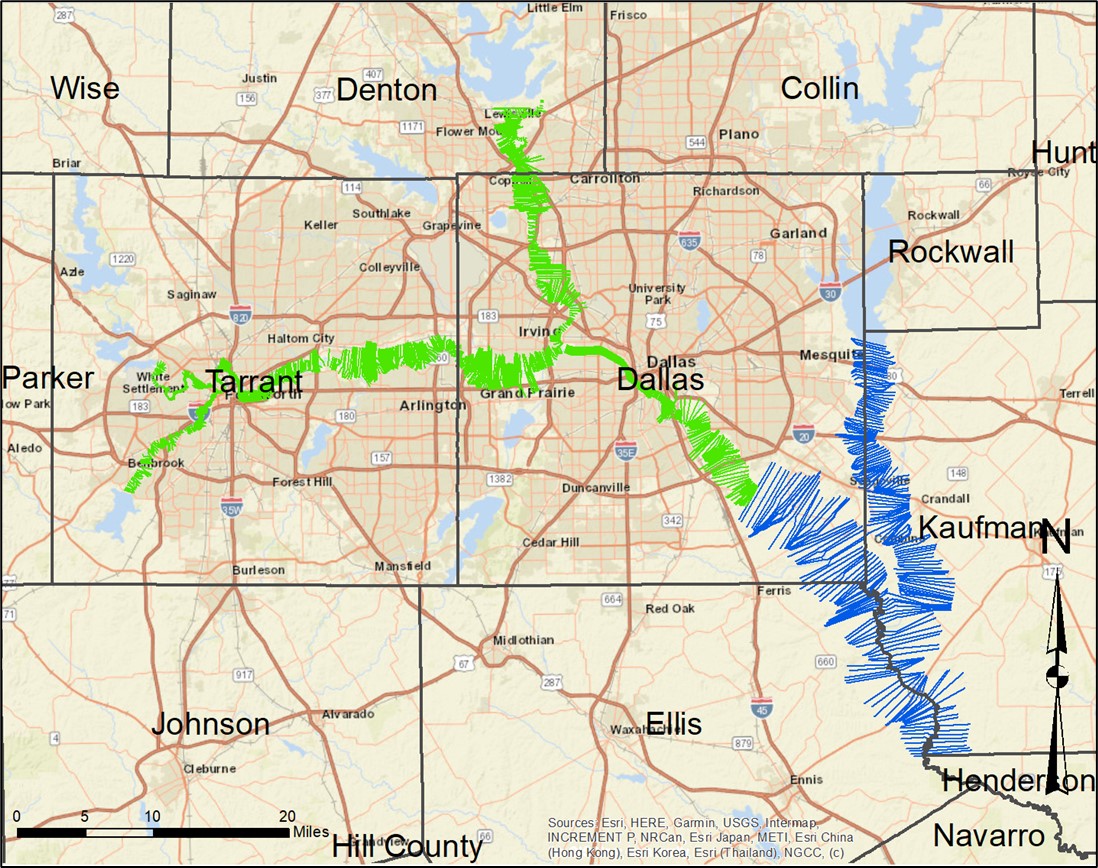 NFIP and CDC Model Extents