Regional Ecosystem Framework
Learn to use this tool |
The Regional Ecosystem Framework, or REF, is a tool that identifies areas of relative ecological importance in the Dallas-Fort Worth region. Transportation partners and local governments that are developing infrastructure projects can use the REF as a preliminary screening tool to identify environmental impacts their projects may have and identify mitigation areas to offset any impacts.
The development of the REF was a collaborative effort between the Transportation and Environment & Development departments at the North Central Texas Council of Governments (NCTCOG) with assistance from resource and regulatory agencies. The tool is based on the Federal Highway Administration's vision to integrate economic, environmental, and social needs during infrastructure development as described in "Eco-Logical: An Ecosystem Approach to Developing Infrastructure Projects."
The REF uses a watershed approach to define areas of ecological importance because ecosystems do not follow city, county, or other political boundaries. The tool evaluates ecological priorities at the subwatershed level using Geographic Information Systems (GIS) and designates scores based on the following.
- Green Infrastructure, including the presence of natural lands, agricultural lands, and wildlife habitat.
- Ecosystem Value, including the rarity and diversity of plants and animals and the sustainability of the ecosystem compared to the entire ecoregion.
- Water Considerations, including the presence of impaired water segments, flood zones, and wetlands; and the quantity of surface water in the subwatershed.
Most REF layers score subwatersheds based on their ecological value relative to other subwatersheds in the Dallas-Fort Worth region. However, three REF layers score subwatersheds based on their ecological value relative to their entire ecoregion, which includes land beyond the Dallas-Fort Worth region. This occurs because the data used for the Diversity, Ecosystem Sustainability, and Rarity layers were developed for the Regional Ecological Assessment Protocol (REAP) produced by EPA Region 6, which covers the South Central United States. For example, subwatersheds in the western counties are located in the Cross Timbers and Prairies ecoregion, so they are compared to the area in Oklahoma that also falls within the Cross Timbers and Prairies.
Mapping Function
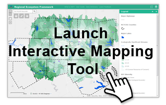
NCTCOG created the Regional Ecosystem Framework Interactive Viewer to share the REF layers and other pertinent environmental layers with transportation and resource agency partners. The interactive tool allows users to overlay REF ecological data with additional spatial data relevant to efforts to conserve natural areas or mitigate the environmental impacts of infrastructure projects.
Data Dictionary
The data dictionary contains descriptions of each of the layers as well as links to the agency or non-governmental organization that produced the data. Governments and planners who are developing infrastructure projects should consult with these and other resource agencies during the planning process.
User Guide
The User Guide gives illustrated descriptions of all the functions available in the Interactive Mapping Viewer. The REF Interactive Viewer is built on Esri’s ArcGIS Online platform and is intended to be a simple-to-use yet in-depth tool. The primary operations are similar to the commonly used Google Maps or Bing Maps. The User Guide and Data Dictionary are also accessible from within the application.
REF Advanced User Guide - Learn how to add layers to the map or access REF data in ArcMap Desktop
Environmental Matchmaking Tools Webinar
September 30, 2020
North Central Texas Council of Governments
Presentation | Video Recording
TRACES Meeting
June 17, 2015
North Central Texas Council of Governments
Presentation
Implementing Eco-Logical Stakeholder Meeting
June 4, 2014
North Central Texas Council of Governments
Agenda | Presentation | Meeting Notes
Regional Ecosystem Framework Update and Identification of Regional Focus Areas - Fall 2014
Loop 9 Conservation Vision and Opportunities - January 2015
Regional Ecosystem Framework Final Report - Completed June 2011
- User’s Guide
- Appendix A: Watersheds in North Central Texas
- Appendix B: Eight-Step Approach to Watershed Planning
- Appendix C: Watershed Roundtable Meetings Comments
- Appendix D: Vision North Texas Policy Areas by HUC-12 Subwatershed
- Appendix E: REF Methodology and Calculations
- Appendix F: Integrating Environmental and Transportation Planning
- Appendix F 2: Resource Agency Management Plan Summary
- Appendix G: Pilot Area Characteristics